AWWS GFA
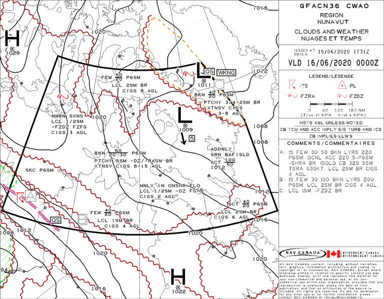
The term AWWS GFA refers to NavCanada‘s Aviation Weather Web Site – Graphical Area Forecast. The GFA weather charts depict the most probably weather in a given area below 24,000ft. The charts include 3 clouds and weather and 3 icing, turbulence and freezing level that are valid for a specific time period, normally 6 hours each for the first two charts and the last chart for 12 hours.
| Select a region to get the associated meteorological products. | |
|
|
|
Using NavCanada’s website, pilots can also view the AWWS Metar and Additional AWWS weather to help with flight planning.
In our Private Pilot Ground School and Commercial Pilot Ground School, we suggest pilots approach the GFA as a large scale area forecast. This means that the weather depicted on the AWWS GFA may not actually happen. Pilots should begin a weather briefing by looking at large scale charts, like a prognostic chart or surface analysis chart, to first understand the large scale weather patterns occurring in Canada.
Then, the GFA can be used to understand regional patterns and confirm or deny the large scale forecasts. Finally, TAFs, METARs, and PIREPs should be used to confirm or contradict the GFA. If the actual weather reports agree with the large scale forecasts, pilots can increase their trust in the AWWS GFA products. If not, extra care should be taken to understand discrepancies. When in doubt, contact your local FIC or FSS for a weather briefing.
AWWS GFA Pacific Region
AWWS GFA Prairies
AWWS GFA Ontario and Quebec
AWWS GFA Atlantic
All Graphical Area Forecasts are published with clouds in feet ASL or above sea level. If a phenomena needs to be stated in AGL, or above ground level, it will be stated on the map.
STNR means stationary on a GFA.
NavCanada is the main provider of the aviation weather web site (AWWS). Pilot can also obtain information from Environment Canada.
QS on a GFA means quasi-stationary. This indicates a synoptic feature is moving at less than 5 knots.


